 If there are other web cams that I have missed and should be in here, please let me know.
 If there are other web cams that I have missed and should be in here, please let me know.
I have been thinking about a New England fall leaves web page for some time.
While doing research I found Jeff Foliage's Fall Foliage webcams of New England Please click on the link and enjoy.
Full credit to Jeff for inventing a wheel before me
 |
Courtesy of See Jackson Hole & Grand Tetons Webcams Cody Bowl
| |
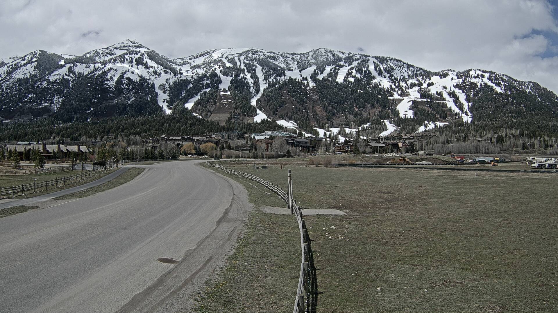 | Courtesy of Jackson Hole Mountain Resort1-888-DEEP-SNOW 1-307-733-2292 3265 West Village Drive Teton Village, WY 83025 | |
 | Courtesy of The National Elk Refuge provides, preserves, restores, and manages winter habitat for the nationally significant Jackson Elk Herd as well as habitat for endangered species, birds, fish, and other big game animals. The Refuge celebrated its centennial in 2012.
| |
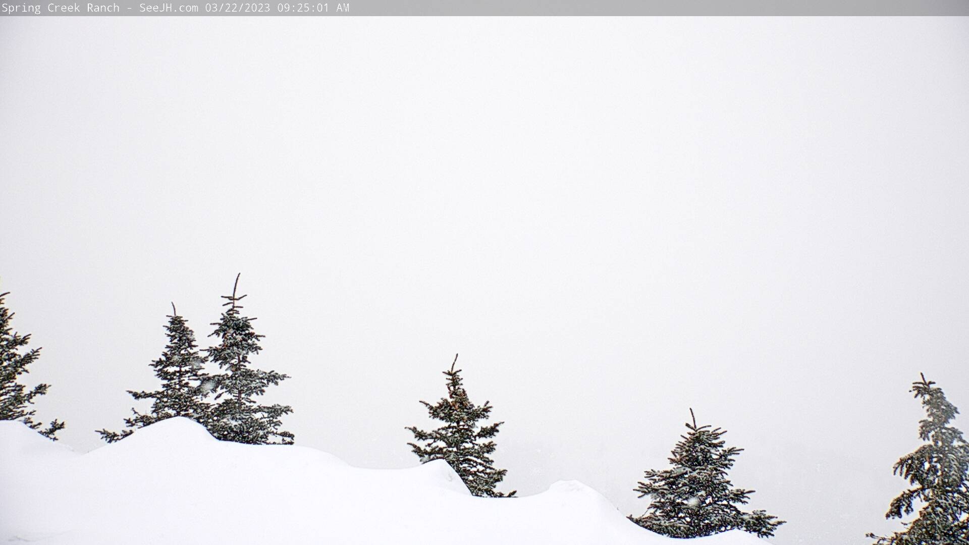 | Courtesy of See Jackson Hole and Spring Creek Ranch Luxury Jackson Hole LodgingSpring Creek Ranch is located on a wildlife sanctuary almost 1,000 feet above the town of Jackson and has the most spectacular views of the Teton Mountain Range, including the world famous 13,700-foot Grand Teton.
| |
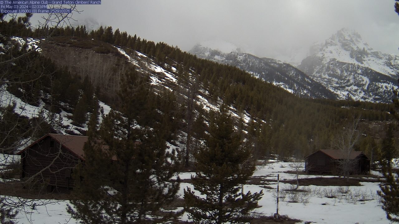 | Courtesy of Grand Teton Climbers' Ranch WebCamThis webcam is located at the American Alpine Club Grand Teton Climbers' Ranch at the base of the Grand Teton. The image updates regularly so you can always know what the conditions are like in the mountains. | |
 | Courtesy of Wyoming Travel Information Service and WDOT | |
 | Courtesy of Spring Creek Ranch is located on a wildlife sanctuary almost 1,000 feet above the town of Jackson and has the most spectacular views of the Teton Mountain Range, including the world famous 13,700-foot Grand Teton.
| |
 | Courtesy of Snake River Flying Saddle Alpine WY Flying Saddle Resort in Alpine, WYLocated in Beautiful Alpine, WyomingLocated on the banks of the Snake River, the Flying Saddle Resort offers all you need for your Wyoming vacation. Fish the famous Snake River or other nearby waterways, hike the surrounding Bridger-Teton National Forest, or take in the views from your personal balcony. Our Alpine, Wyoming hotel and resort features a Western bar, steakhouse restaurant and seven landscaped acres with a tennis court and hot tub.
| |
 | Courtesy of See Jackson Hole and Luton's Teton Cabins Live Video from the Lodge at Lutons Teton CabinsMount Moran at Moran Junction
| |
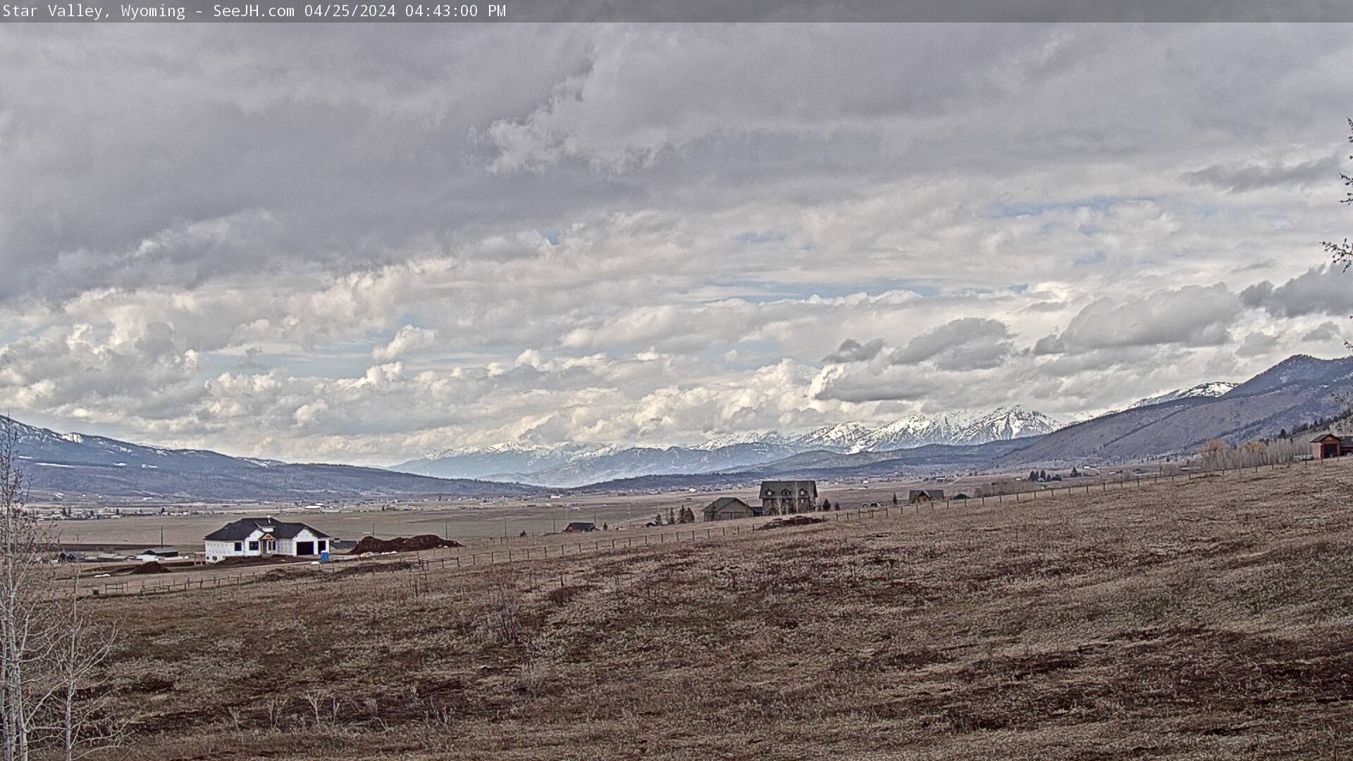 | Courtesy of Star Valley Wyoming WebcamSouthwest of Jackson Hole and on the shores of the Palisades Reservoir, Star Valley is a hub for lots of activity. | |
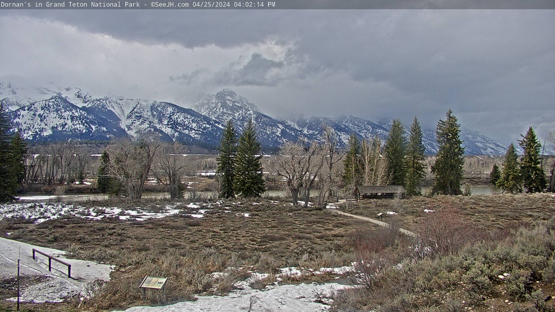 | Courtesy of
WWelcome to DORNANS in Grand Teton National Park and Jackson Hole, Wyoming! | |
 | Courtesy of Teton
Valley Cabins Welcome to Teton Valley Cabins in Driggs, Idaho! Visit us at Teton Valley Cabins and stay in your very own log cabin nestled in a cottonwood forest located at the western base of the majestic Teton Mountains. Just one mile east of Driggs, Idaho on the road to Grand Targhee Ski and Summer Resort. Close to fishing hot spots/a>, great skiing, beautiful hiking trails, and snowmobiling adventures.. Kitchenettes, laundry facilities, picnic area, and hot tub available! | |
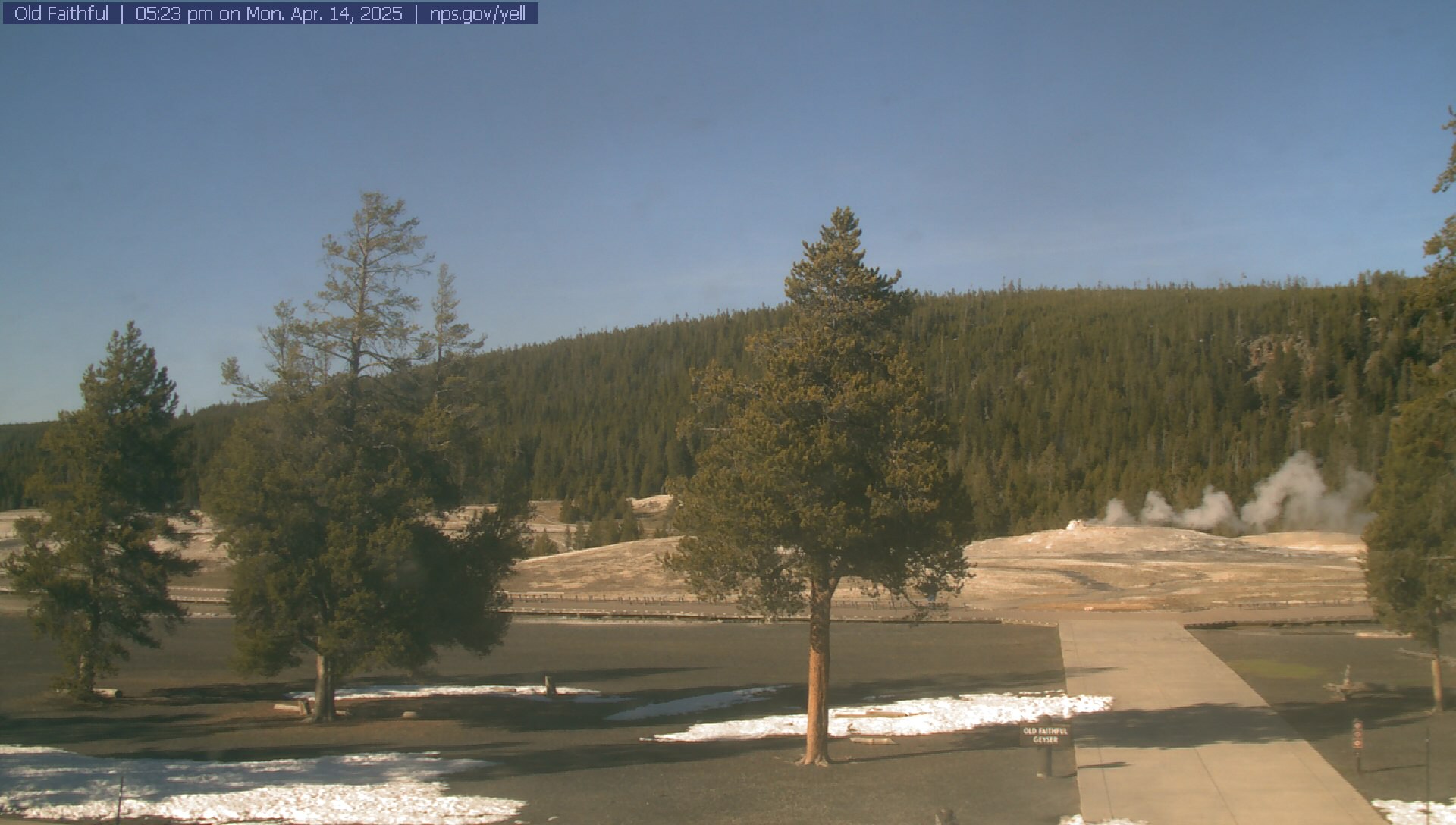 |
Old Faithful VEC Web Cam Courtesy of Welcome
to Old Faithful Geyser
| |
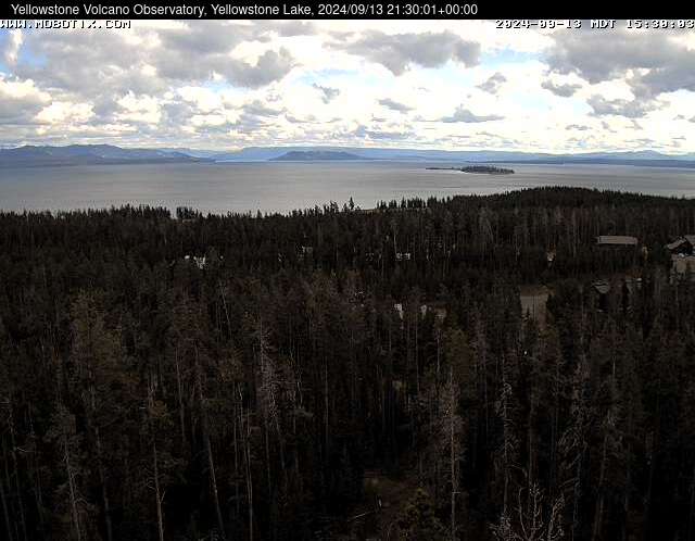 | Courtesy of The
National Park Service - Yellowstone The camera view is south-southeast over Yellowstone Lake from the cell phone tower near Fishing Bridge. Stevenson Island is visible within the lake on the right. The view extends down the Southeast Arm between the Promontory (low ridge rising from the lake) and the eastern shore. Above the shore, the acid-bleached Brimstone Basin remains white even when the snows have melted. The Absaroka Mountains in the background are composed of approximately 50-million-year old volcanic rocks that long precede the current volcanic activity at Yellowstone, which started about 2.2 million years ago. | |
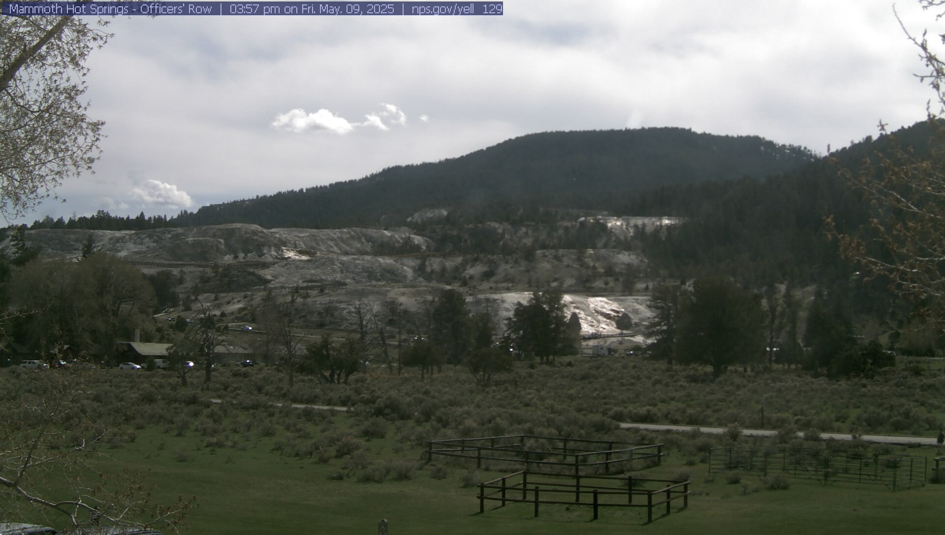 | Courtesy of The National Park Service This Mammoth WebCam shows a real-time still picture of the Mammoth Hot Springs terraces as viewed from the second floor of the Albright Visitor Center through a telephoto zoom lens. | |
 | Fire Lookout WebcamCourtesy of The National Park Service This webcam shows a real-time still picture of the Yellowstone Caldera as viewed from the Mt. Washburn Fire Lookout. Mt. Washburn is just above the northern edge of the caldera and the southern edge is approximately 34 miles away in the far distance in this image. | |
 | Mt. Washburn WebcamCourtesy of The National Park Service This webcam shows a real-time still picture of the Yellowstone Caldera This recently installed second camera at Mt. Washburn is pointed in a northeasterly direction and shows views of both the Absaroka and Beartooth Mountain Ranges. | |
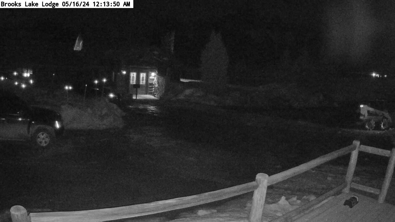 |
Courtesy of Brooks Lake Lodge and Spa in Togwotee Pass, Wyoming Hidden away in Wyoming's Rocky Mountains, not far from Yellowstone National Park, is a quiet vacation resort with rustic cabins and gorgeous scenery. This 100-year-old historic lodge combines a unique blend of country living and outdoor adventure with outstanding accommodations, gourmet dining and 5 star service. It's the ultimate glamping experience. | |
 | Courtesy of Wyoming Travel Information Service Web Cameras I 80 Walcott Junction - mm 234.66 View Facing Elk Mountain | |
 | Courtesy of Wyoming Travel Information Service Web Cameras I 80 Elk Mountain - mm 255.6 View Facing Elk Mountain | |
 | Courtesy of Wyoming Travel Information Service Web Cameras US 287 Pumpkin Vine Scenic View Facing Comanche Peak | |
 | Courtesy of Wyoming Travel Information Service Web Cameras II 80 Vedauwoo - mm 330.70 View Facing North /span> | |
 | Courtesy of Wyoming Travel Information Service Web Cameras II 80 Laramie - mm 317 View Facing Snowies | |
 | Courtesy of Day Weather Day Weather Inc., serving the western United States with weather forecasting services since 1992.
| |
 | Courtesy of Day
Weather DayWeather Inc., serving the western United States with weather forecasting services since 1992.
| |
&  | Courtesy of Mountain View Historic Hotel /a> Centennial, Wyoming Incredibly beautiful mountains, lakes and meadows. | |
& 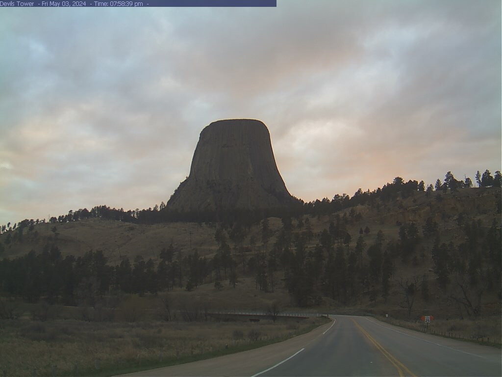 | Courtesy of Devils Tower National Monument This view is the first of the Tower for visitors entering the park just before crossing the Belle Fourche River. | |
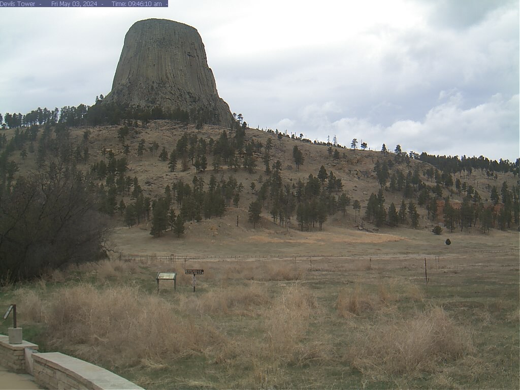 | Courtesy
of Devils Tower National Monument From the amphitheater, you can see the south face of Devils Tower. You can also see the Prairie Dog Town pullouts along the park road from here.& | |
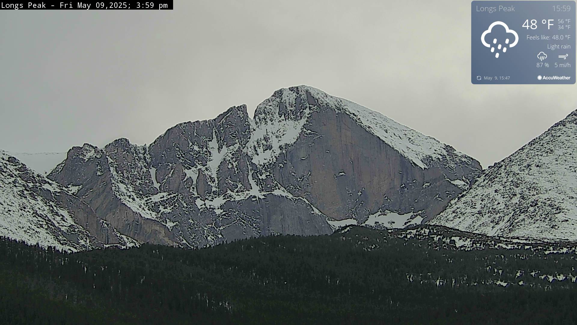 | Longs Peak Web Cam Courtesy of National Park Service Rocky Mountain National Park | |
 | Continental Divide Webcam Located at Glacier Basin Campground, the Continental Divide Webcam& offers a spectacular view of the peaks which rise up from the Bear Lake area. On clear days you will see Thatchtop, Taylor Peak, Otis Peak, Hallett Peak, and Flattop Mountain. View from the kiosk at the entrance to Glacier Basin CampgroundLooking southwest from Glacier Basin Campground in good weather you can see the peaks above the Bear Lake area. From left to right, the peaks are: Thatchtop, Taylor, Otis, Hallett, and Flattop. | |
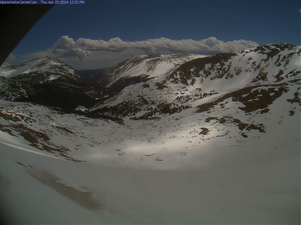 | Alpine Visitor Center WebcamThe Alpine Visitor Center Winter Webcam is located at 11,796 and reveals a morning, midday, and afternoon view of the Fall River canyon, Old Fall River Road, Mount Chapin, and part of Trail Ridge. This location is inaccessible during the winter when Trail Ridge Road is closed due to deep snow and strong winds. At times the view may be obscured by snow or frost and the temperature reading is inaccurate. If the webcam fails, it will not be repaired until the end of May when this location is safely accessible again.Alpine Visitor Center Webcam | |
 | Kawuneeche Valley Webcam Located on the west side of Rocky Mountain National Park one-half mile from the Grand Lake Entrance Station, the Never Summer Mountains look down on the Kawuneeche Valley and headwaters of the Colorado River. Watch for wildlife in this view from the Kawuneeche Valley Webcam. | |
| | Click
for weather forecast/a> This beautiful view can be seen from the Garden of the Gods Club & Resort and the Garden of the Gods Visitor & Nature Center. Courtesy of Visit Colorado Springs, CO | |
 | M Courtesy of Tanda CAD Design is located in beautiful Salida, Colorado. (Check out our web
cam!) Contact us for more information and rates. Tanda CAD Design (719) 207-1563 | |
 | Courtesy ofBlack Canyon of the Gunnison National ParkGunnison PointDeep, Steep and NarrowBig enough to be overwhelming, still intimate enough to feel the pulse of time, Black Canyon of the Gunnison exposes you to some of the steepest cliffs, oldest rock, and craggiest spires in North America. With two million years to work, the Gunnison River, along with the forces of weathering, has sculpted this vertical wilderness of rock, water, and sky.
| |
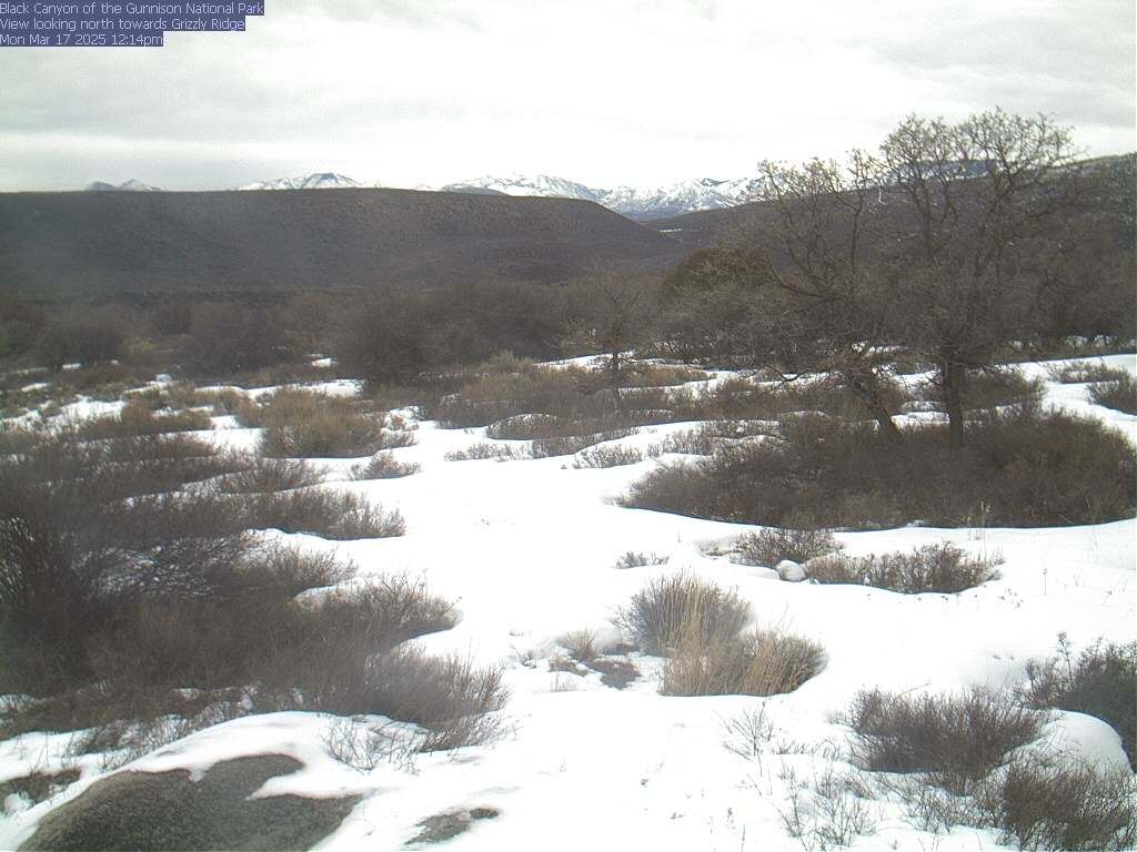 | Courtesy ofBlack Canyon of the Gunnison National ParkGrizzly Ridge | |
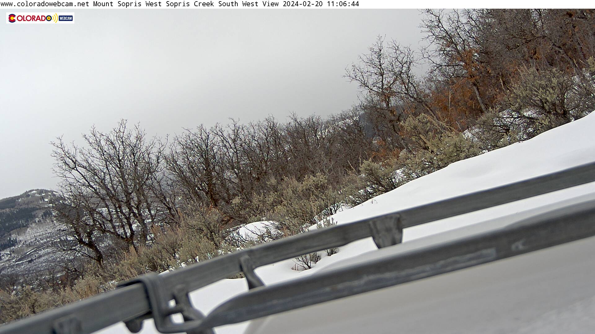
 | East Sopris and West Sopris are about half a mile apart and the same elivation of 12,965. Can be seen from Glenwood Springs, Carbondale, El-Jebel, Basalt a symbol of the roaring fork valley. Named after Richard Sopris a former Mayor of Denver and a first European expidition to the Roaring Fork Valley. When I first came to the roaring fork I was told the Ute Indians in the Valley called it the Magic Mountain.
Courtesy of https://www.coloradowebcam.net/ | |
 | Pikes Peak also known as America's Mountain. Courtesy of https://www.coloradowebcam.net/ | |
 | Colorado National Monument in Fruita Colorado webcam view from the Saddlehorn Visitor Center on Rim Rock Drive. The Colorado National Monument is near Grand Junction in the western part of Colorado near the Utah border and above the Colorado River. You can drive up Rim Rock Drive and make a beautiful tour of cliff edges and high peak views in the red rocks and great rock formations. Lots of great exploring back there and its a great drive and beautiful bike and great hiking. Courtesy of https://www.nps.gov/colm/index.htm | |
 | Blanca Peak Webcam and Mt Lindsey Webcam. Blanca Peak is the fourth highest summit of the Rocky Mountains of North America at 14,344 Feet. Blanca Peak is part of the Sangre de Cristo Mountains which spans half of the state of Colorado. Mount Lindsey is 14,042 feet a high mountain summit on the Sierra Blanca Massif also part of the Sangre de Cristo Range. Courtesy of https://www.coloradowebcam.net/ | |
 | Cottonwood Peak Webcam, Electric Peak Webcam, Mount Owen Webcam, Gibson Peak Webcam are all part of the Sangre de Cristo Mountains. Our webcam in located in the town of Crestone and we are viewing North. Courtesy of https://www.coloradowebcam.net/ | |
 | This Spanish Peaks Webcam is located west of Trinidad and north of Weston off Highway 12. Courtesy of https://www.coloradowebcam.net/ | |
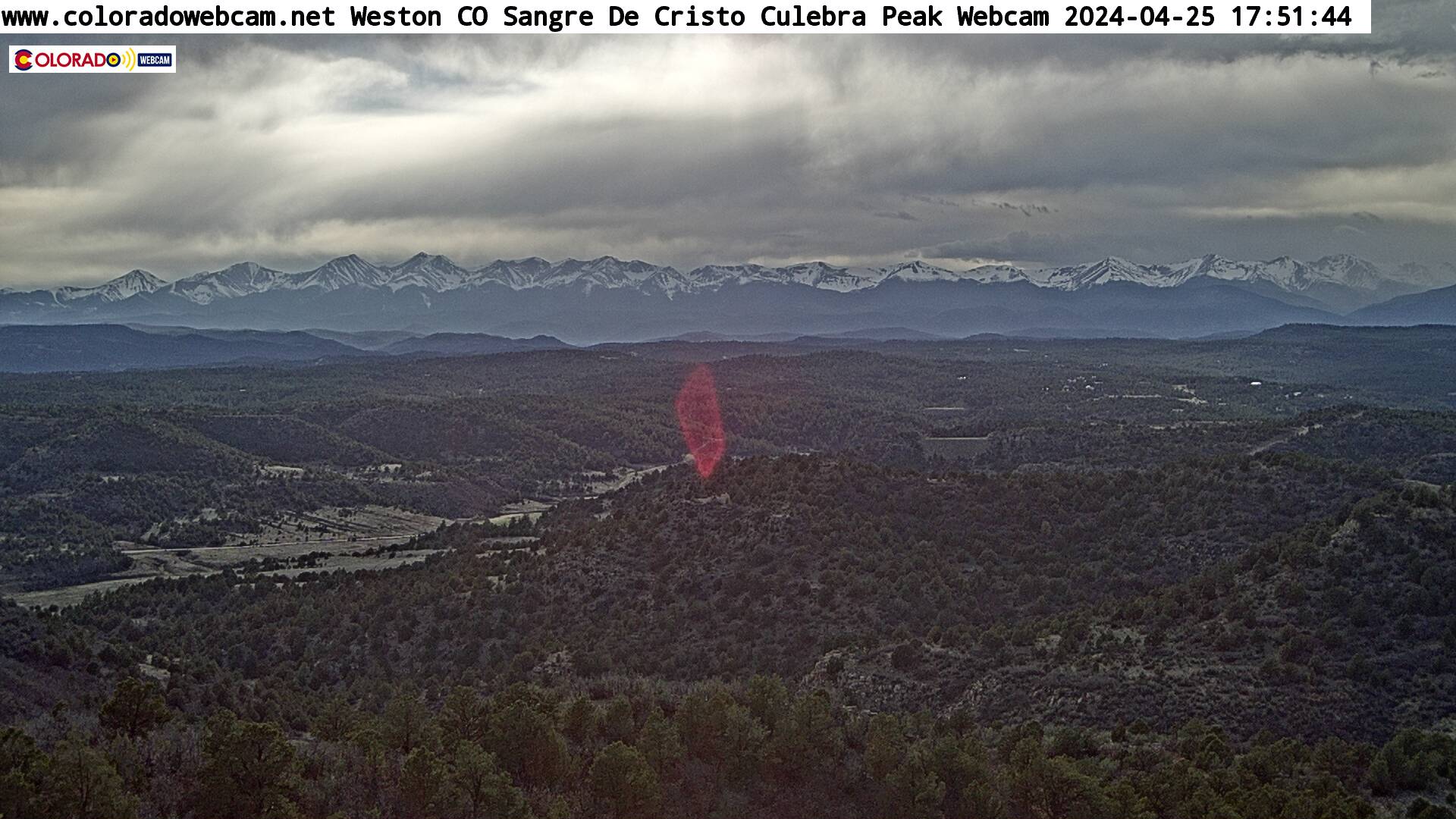 | This Weston Colorado Webcam near Trinidad looking at the Sangre De Cristo Mountain Range, Culebra Peak most southern 14er is Private Ownership is located west of Trinidad and north of Weston off Highway 12. Culebra Peak is the highest summit of the Culebra Range of the Sangre de Cristo Mountains in the Rocky Mountains of North America, 14,049 Feet. The range is located in Costilla County, Colorado. The Sangre De Cristo Mountains includes the following Passes. La Veta Pass, Raton Pass, Poncha Pass, Glorieta Pass. The Blood of Christ Mountains is one of the longest fault-block mountain ranges in the world. Courtesy of https://www.coloradowebcam.net/ | |
 |
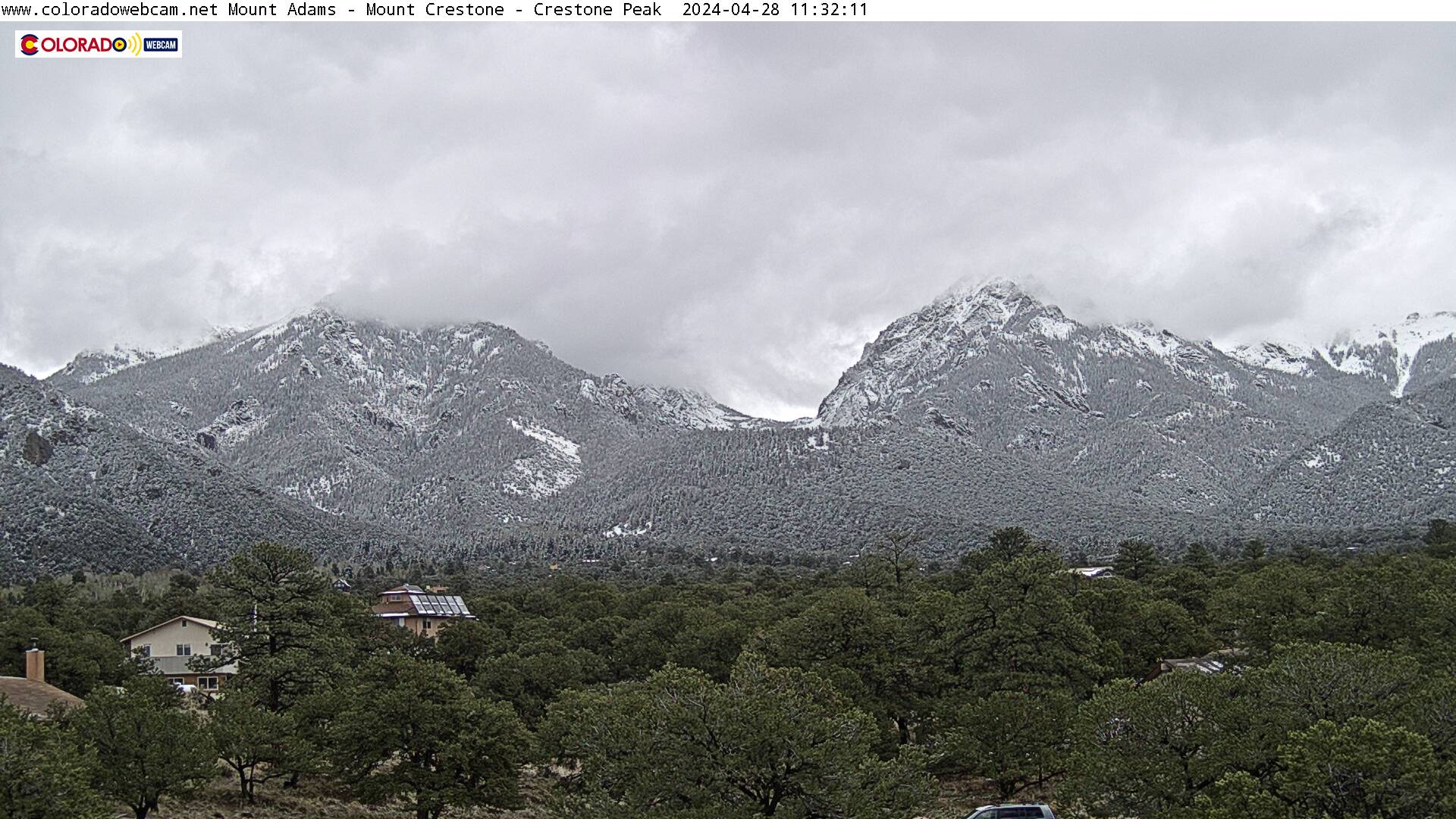
Crestone Peak Webcam, Crestone Needle Webcam, Pico Asilado Webcam, Music Mountain Webcam are all part of the Sangre de Cristo Mountains. The Crestone Needle is 14,203 feet and is a high mountain summit. Crestone Peak to the Left is 14,295 feet and is the seventh highest summit in the Rocky Mountains of North America. Our webcam in located in the town of Crestone and we are viewing East. Courtesy of https://www.coloradowebcam.net/ | |
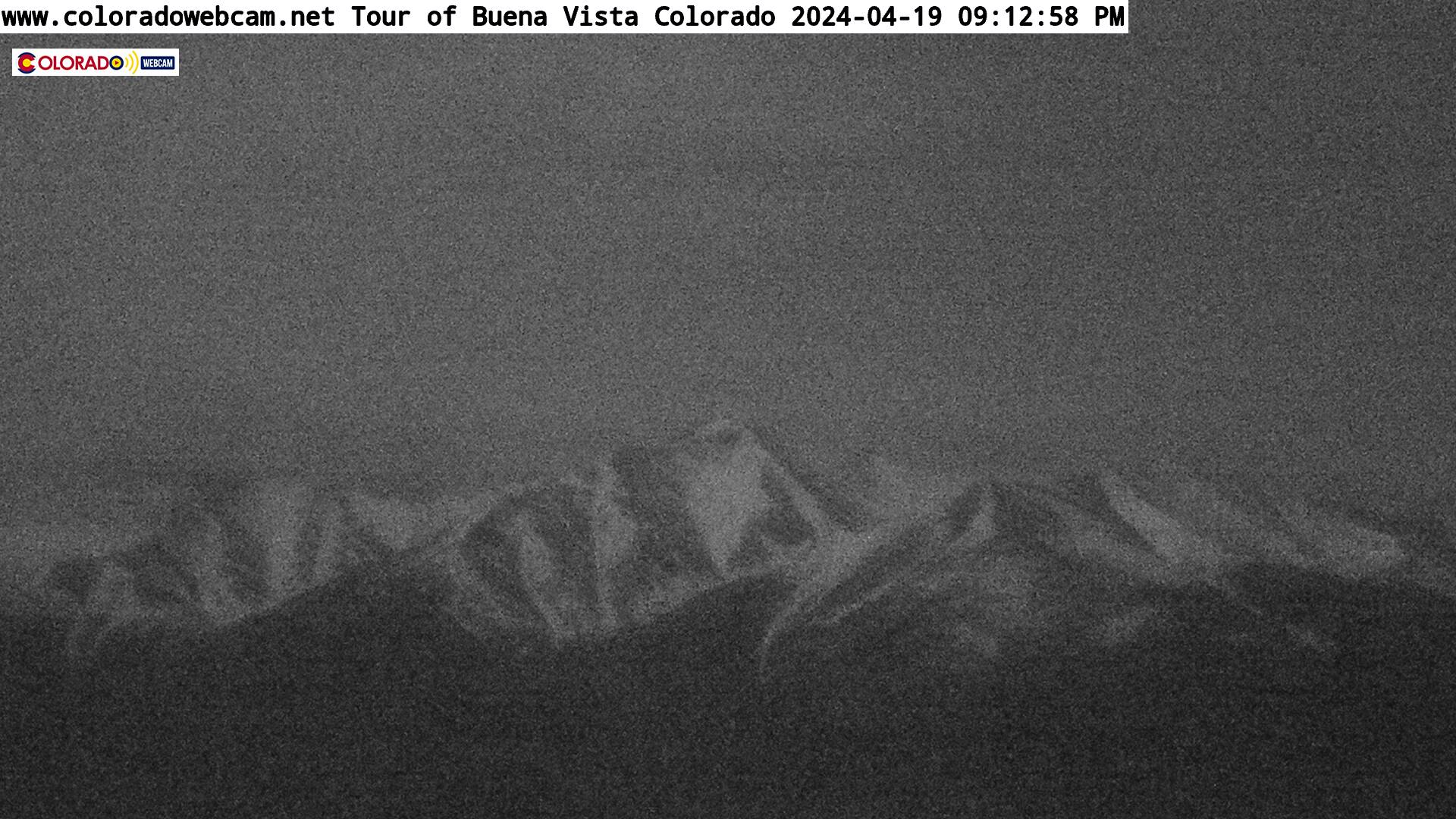 |
Mount Princeton Looking SouthThe Upper Arkansas River Valley is located in the geographic center of Colorado, surrounded by three mountain ranges rising 7,000 feet above the valley floor to an elevation of over 14,000 feet. There are fifteen 14,000 foot peaks in the Sawatch Mountain Range, more than anywhere else in Colorado. More people raft the Arkansas River than anywhere else in Colorado.Courtesy of https://www.coloradowebcam.net/ | |
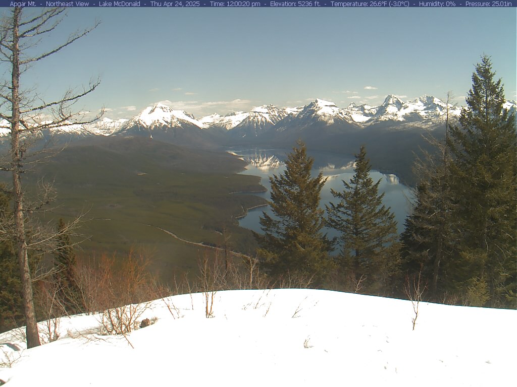
Click for weather forecastCourtesy of Glacier National Park, Montana The view from Apgar Mountain provides an opportunity to share views of the North Fork area of the park. Once a draw for homesteaders, historic old cabins dot the landscape north of the Polebridge Ranger Station. In the 1980s wolves migrated back into this area from Canada, reestablishing packs that had not lived in the park for over 50 years. More recently fires have occurred frequently and in 2003 the large Robert Fire left its mark on the view before you. Notice the spotty nature of the fire with burned and unburned forest mixed together. This diversity of habitat provides ideal conditions for a number of species and is one of the trademark qualities of the North Fork section of Glacier National Park | ||
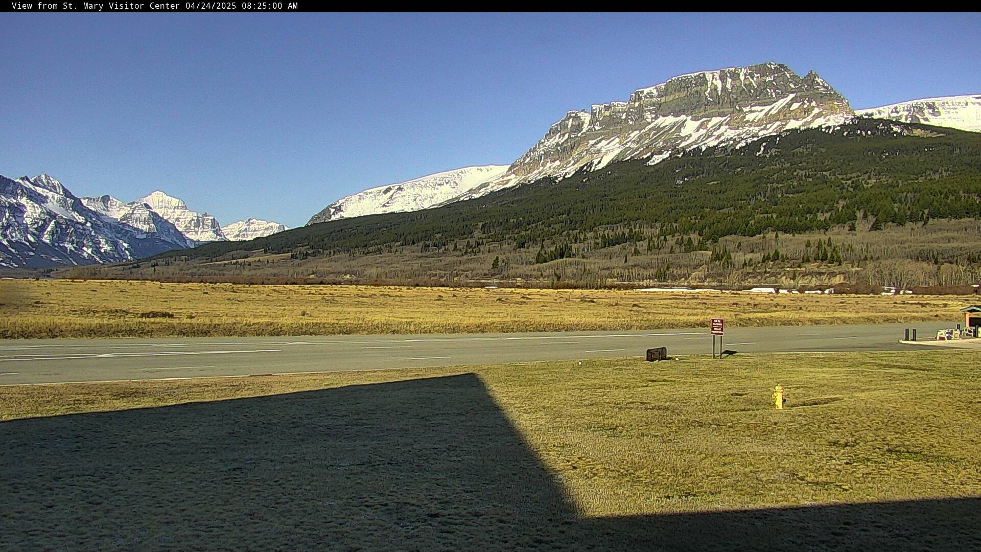
| Courtesy of Glacier National Park, Montana This view from the St. Mary Visitor Center looks out across flower-filled meadows to the majestic peaks surrounding St. Mary Lake. The large central peak in the view is Red Eagle Mountain. Just out of view and to the left would be the St. Mary Entrance Station. On the right is the self-service entrance kiosk. Occasionally there will be people in cars parked there paying their fees. In the summer the cars of park visitors, just entering the park, are often seen. In the winter, on cold snowy mornings, look for herds of elk in the meadows. | ||
| Courtesy of Glacier National Park, Montana The view from this webcam can be changed by park staff and occasionally we will move it and provide a different aspect of the view from the St. Mary Visitor Center. We hope to be able to provide close views of the elk in the fall and winter, tighter views of the mountains, and occasionally people at the Entrance Station and in the Visitor Center. Thanks to the Glacier National Park Conservancy for their continued support of the park's webcam installations. | ||
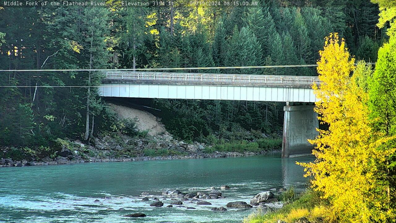 | Courtesy of Glacier National Park, Montana The Middle Fork of the Flathead River forms the southwest border of Glacier National Park. This view, from near Park Headquarters, shows the river as it flows under the West Glacier bridge. At night some of the lights of West Glacier may be visible. During the summer watch for rafters. Several commercial rafting businesses use this section of river. In the winter the only activity along the river might be the occasional coyote or deer or a really cold kayaker. | |
| | Courtesy of Denali National Park This view from high above the Denali Visitor Center is oriented to the southeast, across the park boundary in the middle distance to the Yanert River Valley beyond. In winter, this expanse is where the sun first emerges and lingers low over the horizon. | |
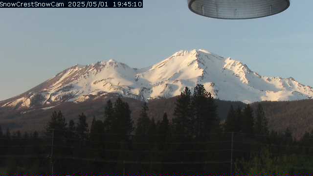 | Courtesy of The SnowCrest Internet Café is located in beautiful downtown Mt. Shasta at the intersection of Mt Shasta Boulevard and Castle Street | |
 | View from Turtleback Dome Courtesy of | |
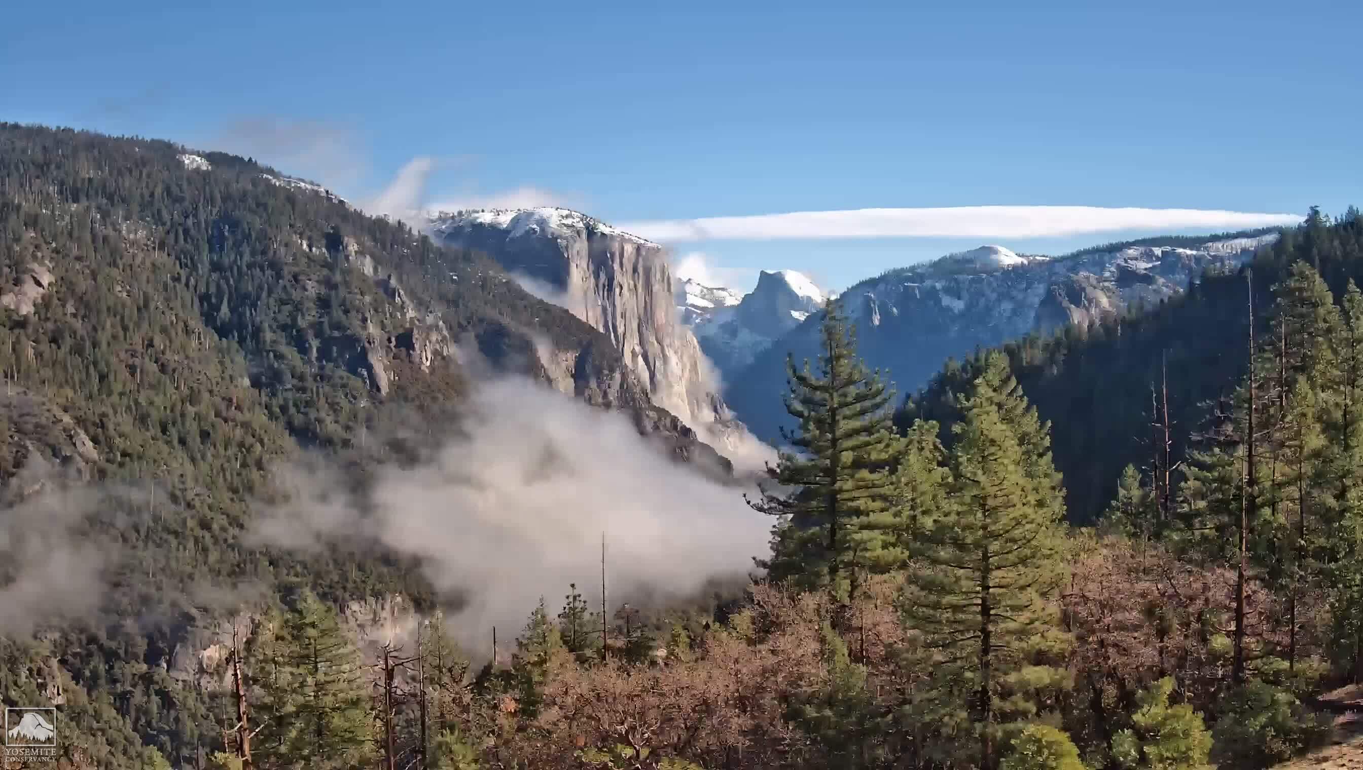 | View from Ahwahnee Meadow Courtesy of | |
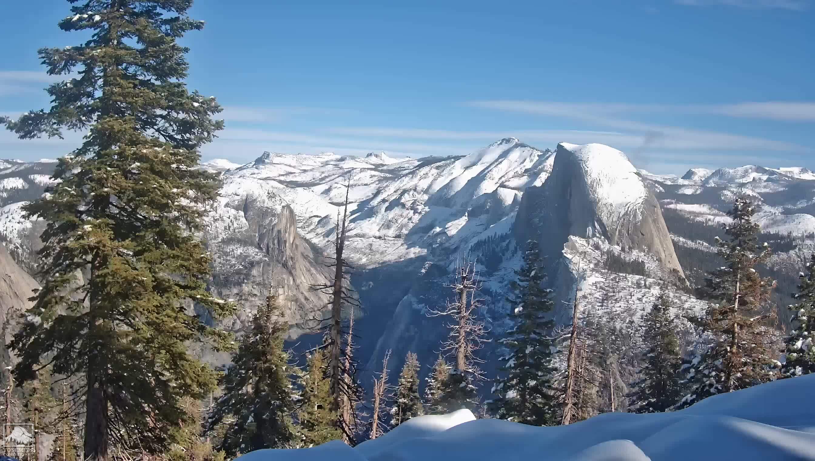 | View from Sentinel Dome Courtesy of | |
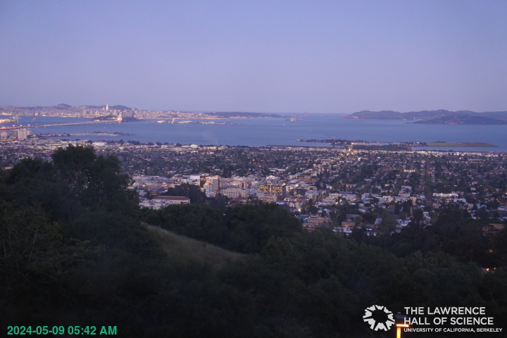 | Courtesy of The Lawrence Hall of Science. Here you can enjoy the view from the Lawrence Hall of Science, overlooking the San Francisco Bay Area. | |
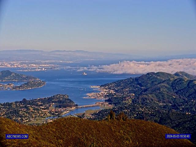 |
Courtesy of KGO San Francisco's ABC Chanel 7
| |
 | Courtesy of www.sheltons.net Mt. Tiburon | |
| | Courtesy of http://www.sigward.com/ Sausalito Wolfback Ridge fire cam | |
| Courtesy of http://www.sigward.com/ Mt. Tam Lookout fire cam MCFD | ||
 | Courtesy of Point
Reyes National SeashoreView of Point Reyes Beach Looking North-NortheastView of Point Reyes Beach Looking North-Northeast from the Point Reyes Lighthouse Visitor Center. Image refreshes every fifteen minutes. | |
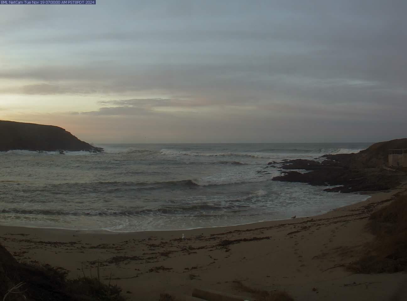 |
Courtesy of UC Davis Through innovative research programs and teaching initiatives, the Bodega Marine Laboratory will lead the way to the multi-disciplinary scientific understanding required to solve complex environmental problems on the marine and terrestrial sides of the tideline in northern California. |

;)